Locations
Check out the maps and info for several of our most loved trails!
You can also check out the new 'Great Trails Victoria' website which has been launched by the Victorian Government.
You Yangs
You Yangs Regional Park is the Geelong Mountain Bike Club's home territory, this is where we hold majority of our races. It is also a great place for general trail riding and a great place to spend a day with the family.
Checkout the Parks Web site for up to date trail access information
Kurrajong is the more family friendly side with flat, non technical tracks to take the kids on, and also have a blast with your riding buddies!
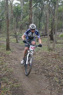
The Stockyards side has lots of technical rocky descents to keep you on your toes, not for the faint hearted, but still hell of a lot of fun!
Left: Dirt Squirts maestro Craig on the flowy Kurrajong trails. Photo by Ryan Lloyd
Right: Club rider Todd on the infamous 'Cressy Descent' trail. Photo by Martin Kier
Anglesea
Stay tuned as GMBC, Dirt Art and Surfcoast Trail Group work with ParksVic to get these amazing trails legalized and repaired.
Check out the Surfcoat TG's Facebook page HERE
Forrest
Forrest is a small town which is becoming a major mountain bike hub of Victoria. Enjoy a pre, mid or post ride coffee at the Corner Store cafe/bike shop or enjoy a local beer and great food from the Brewery.
Forrest has two trailheads:
Yaugher and Southern Trailhead (also known as township trailhead). Trail map HERE (also hard copies available at the Corner Store)
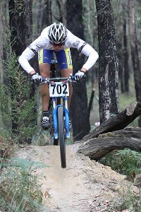
(L) - Ex Junior & Club champ Ryan Lloyd focused on the features of 'Marriners Run'
Wombat
The Wombat State Forest, just outside of the quiet town of Woodend is home to some great trail networks check out the Wombat club website for maps and trail info www.wombatmtb.com.au/trails
Beechworth
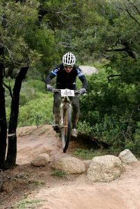
A short distance from the historic town of Beechworth, on Alma Road, is the Beechworth Mountain Bike Park. This park packs 10 km of trail into a small parcel of real estate with plenty of twists and turns. When riding in a group, it can get confusing trying to work out if your mates are coming or going. The intermediate level trail has plenty of rocky sections, so pump your tires up if you're running tubes and carry a spare. The climbing is moderate, but the trail works around lower than the car park, which leaves an uninspired climb to finish off with. The park is a lot of fun if you're competent on rocks, otherwise you might not enjoy it. The rocky sections make good practice for the black runs at the You Yangs. After your ride, head to the local bakery for a Ned Kelly pie.
Lysterfield
Located in Melbourne's eastern suburbs, Lysterfield boasts over 20km of trails. Family friendly riding may be found close to the lake shore on the access roads. A range of flowing trails may be followed around the lake. These tracks are intermediate level with some log obstacles and tree roots. The trail surface is mostly sandy, you won't find many rocks. The elevation gains are moderate. Lysterfield is also home to the 6.3 km state mountain bike course, built for the 2006 Commonwealth games. This challenging trail will test your technical skills and aerobic capacity. There are uphill rock gardens and fast descents. Enjoy a coffee at the café within the park.
More information and trail maps may be found here: http://lysterfieldmtb.com/